Protect your officesand critical assets.
Monitor in real time the locations that sustain your operations (offices, plants, warehouses, routes and suppliers) and receive geolocated alerts as soon as an event occurs that could compromise your business continuity.

Teachers' protest in front of Les Corts
Your business continuity also depends on what happens outside.
A power outage, a protest in front of a site, or a disruption at a logistics hub can stop your operations within hours. Detect these incidents in time through continuous, geolocated monitoring of every key asset.
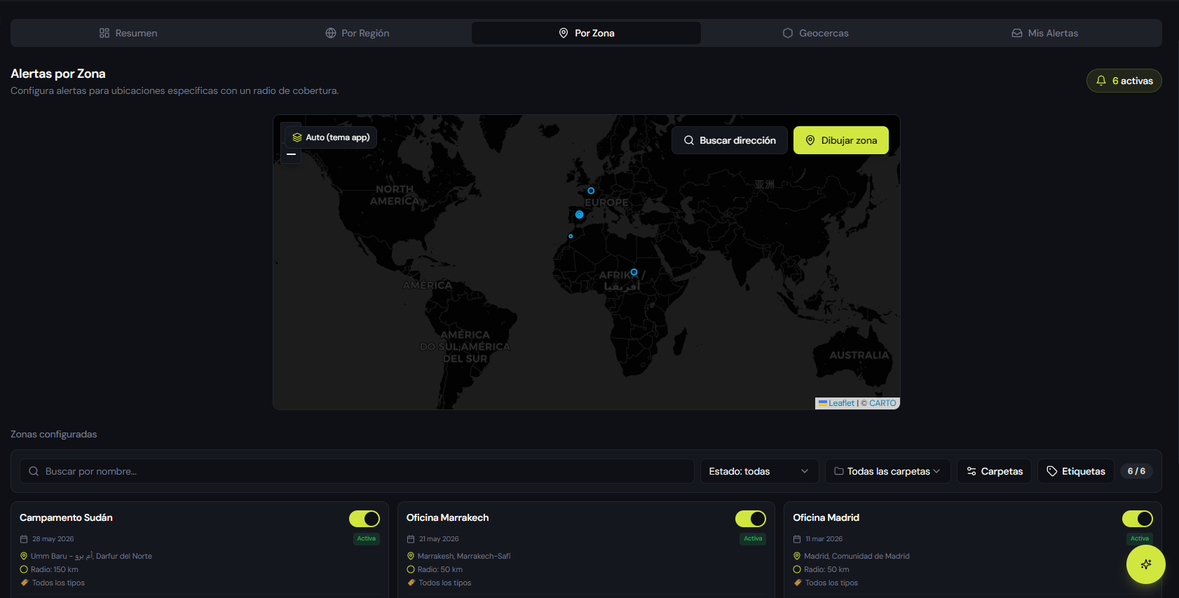
Every location monitored
Register your offices, plants, warehouses or critical infrastructure once. The system monitors their surroundings continuously and alerts you if an incident occurs nearby.
Alerts tailored to each location
Configure the coverage radius and risk categories for each point. Zero noise: your team only receives what affects that location's operations.
A protected supply chain
Monitor routes, logistics nodes and strategic suppliers to detect disruptions in time. Real room to maneuver and activate alternatives before the impact grows.
Define each asset. Choose its radius.Receive only what matters.
Mark every site, office or critical infrastructure on the map and configure the coverage radius that makes sense for that location. When an event occurs within that perimeter, your team will know instantly.
- Precise geolocationDrop an exact point on any site, office or asset worldwide.
- Configurable radiusFrom a few kilometers for urban assets to hundreds for wide areas or camps.
- Customize every alertSet custom filters by category, severity and verification status, and choose the channel where you want to receive alerts.
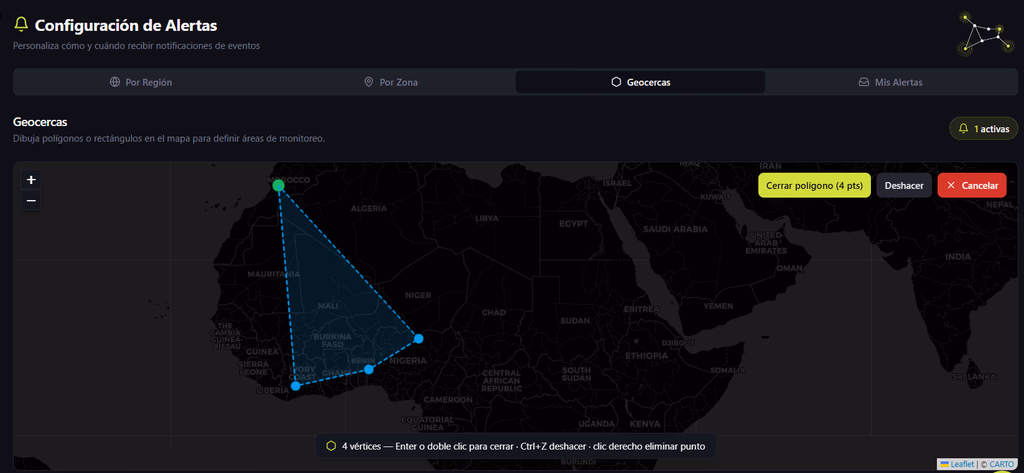
Draw the exact shapeof your operations.
When a radius isn't enough, draw polygons or rectangles on the map to define tailor-made monitoring areas: transport routes, logistics corridors, industrial zones, specific regions or perimeters around strategic suppliers.
- Routes and corridorsDraw the actual path your goods or teams travel along.
- Areas of interestPolygons over regions, industrial parks or critical supplier zones.
- Instant alertsWhen an event enters the geofence, the system notifies you immediately.
A disruption 5,000 km away can also become a major problem for your company.
Business continuity doesn't end at your office door. A port strike, a road blockade or an extreme event in a supplier's region can compromise deliveries, production and revenue. Visualize your supply chain as a single interconnected network to take control of your operational risk.
Plants and factories
Detect threats around your sites with enough lead time to protect operations.
Transport routes
Monitor the logistics corridors your goods travel along and evaluate alternative routes if a problem arises.
Warehouses and logistics hubs
Keep every critical node of your distribution network under watch, wherever it is in the world.
Strategic suppliers
Monitor the surroundings of your critical suppliers' facilities. If a security incident or natural disaster threatens their area, you find out in time to seek supply alternatives.
From alert to decision, no friction.
Real-time alerts
Receive real-time notices about incidents around your critical assets: from power outages and demonstrations to natural disasters. You'll know what's happening instantly.
Activate contingency plans
Each alert arrives with the key data and context needed to activate internal response protocols quickly and with verified information.
End-to-end resilience
Visualize all your sites, critical infrastructure and routes on a single map and understand at a glance where the risk is at any moment.
Protect your supply chain today
Define your sites, routes and critical zones in minutes. Start receiving geolocated alerts and safeguard the continuity of your operations.